

Aravaipa Canyon Wilderness: Hiking, Access and Trip Planning
Aravaipa Canyon Wilderness

Aravaipa Canyon Wilderness is one of Arizona’s most distinctive backcountry landscapes: a deep desert canyon built around a year-round flowing creek, with towering rock walls, dense riparian forest, abundant wildlife, and remarkably little developed infrastructure.
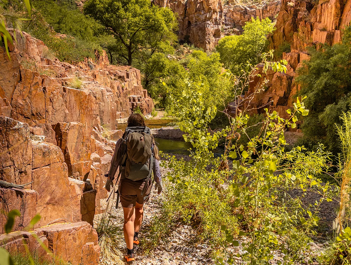
There are no maintained hiking trails through the main canyon. Instead, much of the journey follows Aravaipa Creek itself—walking along gravel bars, pushing through vegetation, and crossing the water again and again.
That makes Aravaipa very different from a typical Arizona hiking destination. You aren’t simply following a trail to a viewpoint. You’re traveling through a living canyon.
You can experience Aravaipa as a day hike, overnight backpacking trip, natural-history excursion, or approximately 12-mile thru-hike between the east and west entrances.
Permits are required for recreational entry into the wilderness.
Aravaipa Canyon at a glance
Location
Southeastern Arizona, between the Tucson and Phoenix regions
Wilderness size
19,410 acres
Main canyon
Approx. 12.25 miles
Water
Aravaipa Creek flows year-round
Trail
No maintained through-trail
Permits
Required
Maximum stay
3 days / 2 nights
Camping
No designated campsites
Main entrances
West and East
Best for
Hiking, backpacking, wildlife watching, photography & natural history
Why Visit Aravaipa Canyon?
Aravaipa feels unusual because two very different Arizona landscapes meet in the same place. Above you are cliffs, desert slopes, cactus and dry mountain country. At creek level, cottonwoods, sycamores, willows and other riparian vegetation create a shaded green corridor around flowing water.
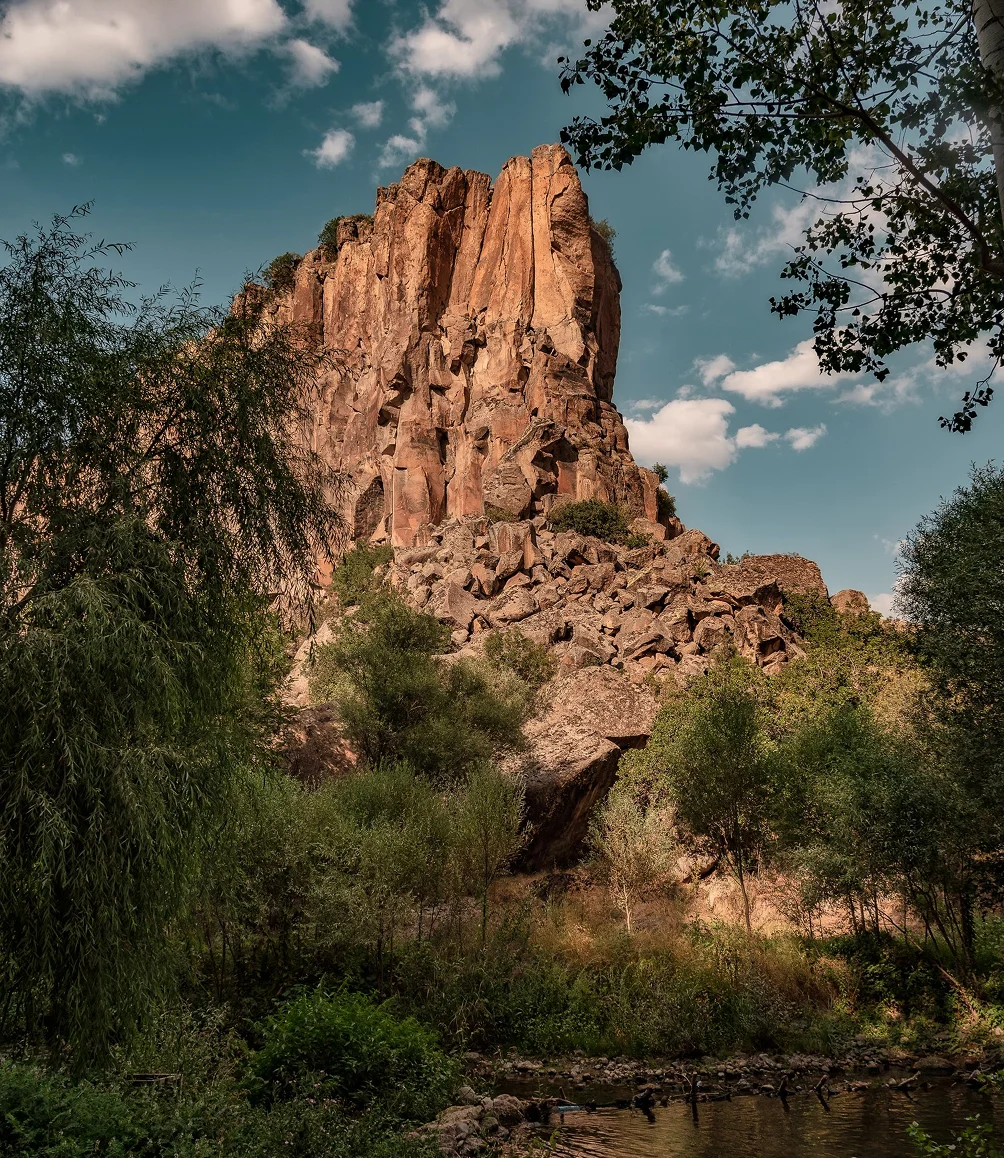
This isn’t really a “trail” → That distinction is important.
You will sometimes find footpaths along the banks, but much of the easiest travel is directly in or beside the creek.
Expect wet feet.
Expect uneven cobble.
Expect vegetation.
Expect to occasionally stop and figure out the easiest way forward.
That is part of what makes Aravaipa special.
That contrast makes Aravaipa especially rewarding for people interested in more than simply covering miles.
It is an excellent destination for:
- hikers who want a genuinely wild backcountry experience
- first-time backpackers ready for something more adventurous than a maintained trail
- experienced backpackers looking for an unusual Arizona trip
- birders and naturalists
- photographers
- families and small groups comfortable outdoors
- people who want to slow down and spend time exploring rather than race toward a summit
Aravaipa Creek flows year-round, supporting an unusually rich riparian ecosystem within the surrounding desert.
Hiking Aravaipa Canyon
The main canyon runs approximately 12.25 miles between the west and east trailheads.
That number can be misleading.
Twelve miles on a maintained trail and twelve miles through Aravaipa are not quite the same thing. Water crossings, loose rock, vegetation, route choices, photography, wildlife sightings and side-canyon exploration all slow the pace.
BLM suggests that strong hikers traveling primarily from destination to destination may make the traverse in roughly 8–10 hours, while visitors interested in exploring the canyon often spend one or two nights.
You don’t have to hike the whole canyon
In fact, many visitors shouldn’t.
You can enter from either end, explore several miles of the canyon and then return to your vehicle.
For naturalists, photographers and people visiting Aravaipa for the first time, less mileage can often produce a better trip.
The canyon rewards stopping.
Day Hiking, Backpacking or Thru-Hiking?

Day hiking
A day hike is the simplest introduction to Aravaipa.
Enter from your permitted trailhead, travel as deeply into the canyon as your time and ability allow, and retrace your route.
This eliminates campsite decisions and vehicle logistics while still providing an excellent feel for the canyon.
Good for: first visits, naturalists, photographers and hikers who don’t want to carry overnight equipment.
Backpacking
Spending a night or two inside Aravaipa changes the experience substantially.
Once the day hikers leave, the canyon becomes even quieter. Backpacking also gives you enough time to explore side canyons, watch wildlife, linger beneath the trees and experience different parts of the canyon at different times of day.
There are no designated campsites, so campsite selection is part of the trip.
Maximum recreational stays are currently three days and two nights.
Thru-hiking Aravaipa Canyon
A thru-hike begins at one end of the wilderness and finishes at the other.
It’s an elegant way to experience the entire main canyon without retracing your steps.
It also creates one obvious problem:
your vehicle is at the wrong end of the canyon when you finish.
Because the two trailheads are approached from very different road systems, arranging your own vehicle shuttle can consume a surprising amount of time.
Moonflower offers trailhead shuttle service for Aravaipa thru-hikers.
East vs. West Aravaipa Canyon Access
Aravaipa has two principal entrances.
They are not interchangeable from a logistics standpoint.
West Trailhead
The West Trailhead is generally the more convenient approach for visitors coming from Tucson or Phoenix.
BLM describes the approach as approximately 12 miles from Arizona Route 77, with the first portion paved and the remaining road unpaved.
For many first-time visitors, the west side is therefore the simpler introduction to Aravaipa.
Parking at the West Trailhead
Parking is limited, and Recreation.gov currently asks permit holders to bring no more than two vehicles per permit.
West-side visitors may also use the Brandenburg Ranger Station and carpool the final stretch when necessary. Your permit includes the parking authorization that should be displayed in your vehicle.
East Trailhead
The East Trailhead is considerably more remote.
BLM describes the approach as roughly 46 miles of dirt road from U.S. 70, including eleven creek crossings. A high-clearance vehicle is required, and flooding can make the road impassable.
That extra remoteness is part of the appeal of the East side—but it deserves serious consideration when planning transportation.
Parking at the East Trailhead
Parking is limited, and Recreation.gov currently asks permit holders to bring no more than two vehicles per permit. If the trailhead parking is full, we recommend parking along Turkey Creek.
Planning a thru-hike?
Aravaipa Canyon Permits
A permit is required to enter Aravaipa Canyon Wilderness for hiking or backpacking.
Because visitation is intentionally limited, desirable dates—particularly during good hiking weather—can fill.
Permits are currently released through Recreation.gov 13 weeks before the entry date, and reservations can cover up to three days.
Trying to understand the reservation system—or can’t find a permit for the dates you want?
We’ve created a complete guide to Aravaipa Canyon permits, including when permits become available, how the entry system works, and what options you may still have if your preferred dates appear unavailable.
Aravaipa Canyon Weather & Best Time to Visit
There isn’t one universally “best” season in Aravaipa.
The experience changes substantially through the year.
01/
Spring
Spring can bring pleasant hiking temperatures, active wildlife and green vegetation. It is understandably one of the more desirable times to visit.
02/
Summer
Summer means serious desert heat as well as the possibility of monsoon thunderstorms and flash flooding. The presence of flowing water does not make Aravaipa a casual summer hike.
03/
Fall
Fall brings moderating temperatures and eventually changing leaves in the canyon’s cottonwoods and other riparian trees.
04/
Winter
Winter can provide excellent hiking conditions during the day, but temperatures can become cold—especially overnight and in shaded portions of the canyon.
More important than the season: the actual forecast
Weather elsewhere in the watershed matters.
A thunderstorm does not have to be directly overhead to create dangerous conditions downstream.
BLM specifically warns that flash floods are common in Aravaipa and recommends checking both weather forecasts and current creek-flow information before entering.
Interested in Aravaipa but aren’t sure you’re ready to do it alone?
Our private Aravaipa trips are designed around the people actually coming with us—not around keeping up with a scheduled group.
How Difficult Is Hiking Aravaipa Canyon?
Aravaipa is unusual because it is physically moderate but environmentally complex.
There is relatively little elevation gain through the main canyon.
But hikers deal with:
- repeated creek crossings
- slippery and uneven rocks
- loose cobble
- thick vegetation
- route finding
- wet footwear
- changing water levels
- heat or cold
- remote terrain
- limited communications
BLM notes that there are no maintained trails, campsites, signs or facilities within the wilderness. Cell service should not be expected.
Is Aravaipa Canyon good for beginners?
It can be. Aravaipa can actually make an excellent introduction to backpacking for the right beginner.
The distances can be kept modest. Water is present throughout the main canyon. There are no enormous mountain climbs. And an overnight trip can feel extraordinarily remote without requiring a week-long expedition.
But there is an important qualification:
Aravaipa is not a beginner hiking trail. It is beginner-accessible wilderness.
A new backpacker should either have someone in the group who understands backcountry navigation, weather, water treatment, campsite selection and emergency decision-making—or go with a guide.
Aravaipa Canyon Safety
Most trips through Aravaipa are straightforward.
But wilderness travel becomes safer when you understand the handful of things that actually matter.
Flash flooding
This is the major environmental hazard.
Aravaipa Creek drains a much larger watershed than the patch of sky directly above you. Heavy rainfall upstream or in a side canyon can change creek conditions where you are.
Never enter a flooding creek.
Move to high ground and wait.
BLM notes that strong floodwaters can contain large trees, rocks and other debris and may take many hours to recede.
Water
Heat and sun
Communication
Footing
Wildlife & Natural History
For many people, wildlife is the reason to visit Aravaipa.
The perennial creek creates one of the Southwest’s unusually rich riparian corridors, supporting vegetation and wildlife that would be impossible across much of the surrounding desert.
Rather than treating Aravaipa simply as twelve miles to complete, try traveling slowly enough to notice what is around you.
Look for tracks beside the creek.
Watch the canopy.
Listen before entering the next bend.
Investigate side canyons.
Notice where desert vegetation gives way to the riparian corridor.
Aravaipa becomes much more interesting once you stop treating it primarily as a hiking route.
How to Have a Better Aravaipa Trip
Don’t automatically maximize mileage.
Aravaipa rewards exploration more than speed.
Some of the most memorable places are away from the main corridor.
Expect wet feet. Trying to keep your shoes dry all day usually makes travel slower and more frustrating.
Pay attention to the creek.
Its clarity, depth and flow tell you something about what is happening elsewhere in the watershed.
Stop.
Sit beneath a sycamore.
Watch an animal.
Explore a rock formation.
Spend twenty minutes somewhere for no particular reason.
The secret to Aravaipa isn’t seeing everything. It’s giving the canyon enough time to reveal something.
Exploring Aravaipa
With a Guide

You do not need a guide to experience Aravaipa Canyon.
Many people shouldn’t use one.
If you are an experienced wilderness traveler, enjoy planning your own trips and simply need help moving a vehicle from one trailhead to the other, our Aravaipa shuttle service may be all you need.
But guiding can make sense if you:
- are relatively new to backpacking
- want someone else to handle logistics and permits
- are traveling with a partner or family member with different experience levels
- want to understand more of what you’re seeing
- would rather spend your limited time exploring than figuring everything out
- want to go deeper into the canyon without carrying the cognitive load of managing the trip
Moonflower Guide Co. leads private trips rather than scheduled group tours.
That gives us the freedom to adjust pace, mileage and emphasis around the people actually traveling with us.
Not sure you need a guide? Here’s how to decide.
Aravaipa Canyon
Wilderness FAQ
Do you need a permit to hike Aravaipa Canyon?
Yes. Recreational visitors need a permit to enter Aravaipa Canyon Wilderness, including the main canyon and side canyons. Permits are issued through Recreation.gov.
How long is Aravaipa Canyon?
The main canyon is approximately 12.25 miles between the east and west trailheads.
Can you day hike Aravaipa Canyon?
Yes. You do not have to hike the entire canyon. A day hike from either entrance can be an excellent way to experience Aravaipa.
Can you backpack in Aravaipa Canyon?
Yes. Permits can currently cover stays of up to three days and two nights. There are no designated campsites.
Is there a trail through Aravaipa Canyon?
Not in the conventional sense. There are intermittent paths, but much of the journey involves walking beside or directly through Aravaipa Creek.
Do you need four-wheel drive for Aravaipa Canyon?
The answer depends on the entrance. The west approach is considerably simpler. BLM requires a high-clearance vehicle for the east approach, which includes dirt roads and unbridged creek crossings. Conditions can change after storms.
How do you thru-hike Aravaipa Canyon?
Enter from one permitted trailhead and travel approximately 12.25 miles through the main canyon to the opposite entrance. Because your vehicle would otherwise remain at your starting point, most thru-hikers need to arrange a second vehicle or shuttle.
Is Aravaipa Canyon suitable for beginner backpackers?
It can be an excellent beginner wilderness trip for someone with appropriate preparation or an experienced companion.
The terrain isn’t mountainous, but creek travel, weather, route finding, campsite selection and remoteness make it very different from backpacking on a developed trail.